So, how better to start #30 Days Wild than with the first day of this year’s long distance footpath, the Weardale Way? Where the River Wear starts is rather less clearly defined than the start of Hadrian’s wall but I had the map and voted we start at Killhope Lead Mining Museum, though Gill pointed out that the ‘river’ is actually Killhope Burn here. The River Wear itself doesn’t form until Killhope Burn and Burnhope Burn merge at Wearhead; the clue being in the name, I suppose!
Anyway, the upshot was that we dropped one car at Westgate and drove on up to Killhope to start our walk.

Start of the Weardale Way, at Killhope Lead Mining Centre
The path starts with a climb up around Weardale Forest above the museum site. The buildings and mining paraphernalia are a salutary reminder of how different this serene valley would have looked in the late 19th Century when lead mining was a major industry, as are the spoil heaps, mine and quarry ponds and ‘hushes’ scattered along the route. In the early days of lead mining, streams were dammed then the water released down these hushes to strip away soils and reveal ore veins and to remove rock debris.

One of the reservoirs above Killhope used to drive the giant water wheel, built by William Armstrong of Cragside in the late 1870s, to separate lead ore (galena) from waste
It’s good to see that where conifers have been felled, above Killhope, they are being replaced by native species such as hawthorn.

Looking east from above Weardale forest with new, native tree seedlings
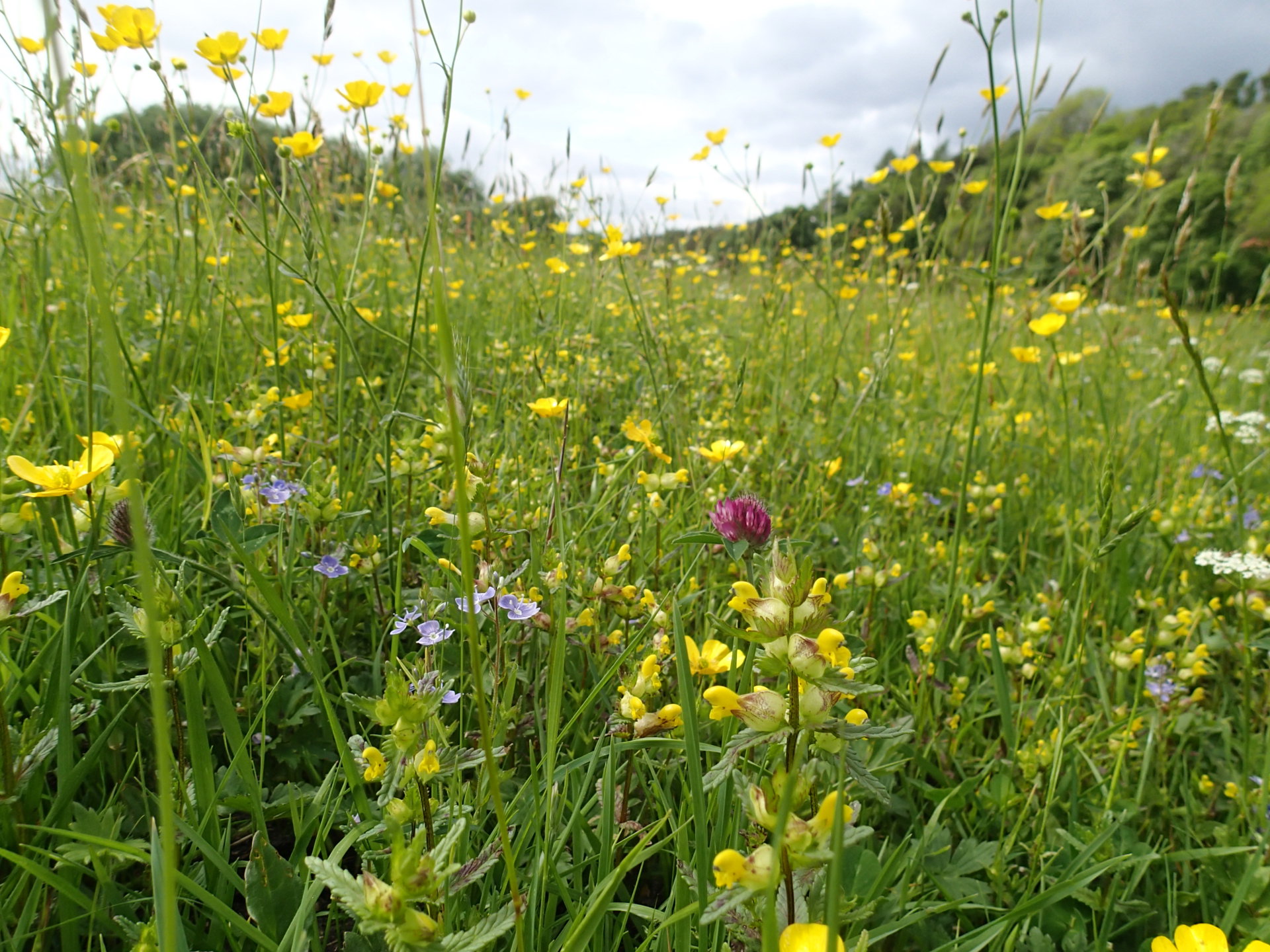
One of the nicest things about today’s walk is the contrast between the wild moorland here and the beautiful meadows along the river between Cowshill and Westgate. There are flowers all the way though, starting with mountain pansies and spring sandwort – heavy metal tolerant species often associated with the lead mining spoil.


Viola lutea (left) and Minuartia verna (right)
There are plenty of rocks along the way to keep Robert interested and we accidentally stray onto a path signposted, ‘Mineral Valleys Walk’ which whets his appetite to return for more. The waymarking is not quite as reliable as along Hadrian’s wall. A particular favourite is the illegible signpost near the disused Cuthbert’s level (mine entrance) which has a fine crop of nutrient-tolerant lichens as a result of a close encounter with a muck spreader.

We drop down to the confluence of Killhope and Wellhope burns, before climbing up again past Blakely Field and High Rush. Here we are serenaded by an astonishing range of birds, keen to distract us from their nesting sites. The larks and lapwings are joined by curlews, dunlins and snipe, which make an extraordinary drumming noise as they wheel and dive.

Looking west towards Blakely Field and Killhope
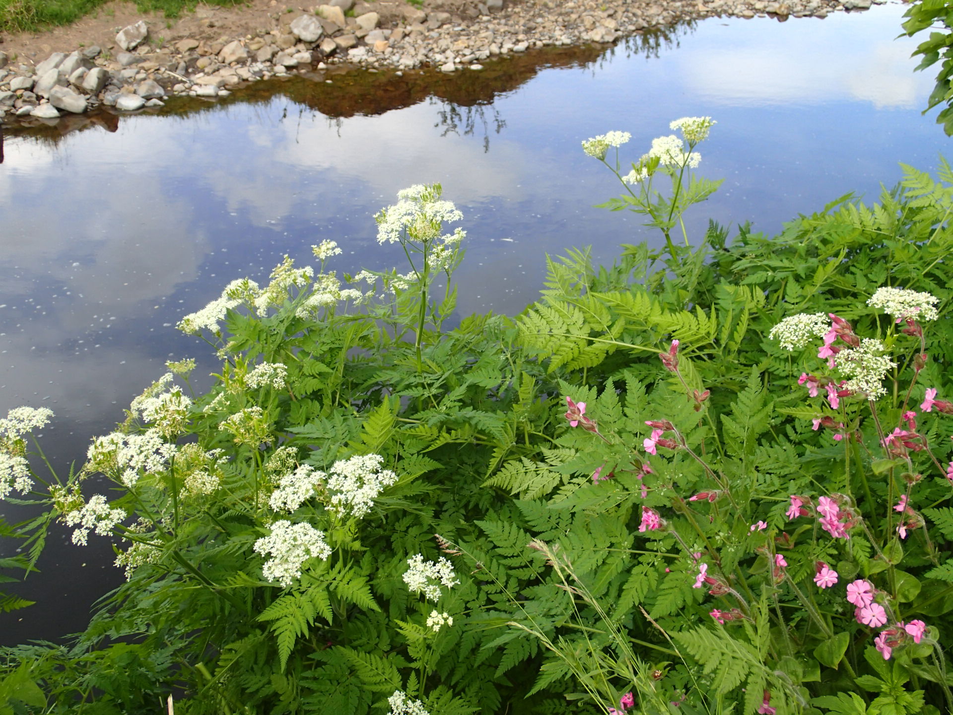
By the time we meet Killhope Burn again, at the aptly-named Heathery Bridge, it’s time for lunch in a field with plenty more flowers – marsh thistle, forget-me-nots, water avens, pignut, wood crane’s bill and the first (northern marsh) orchid of the day.


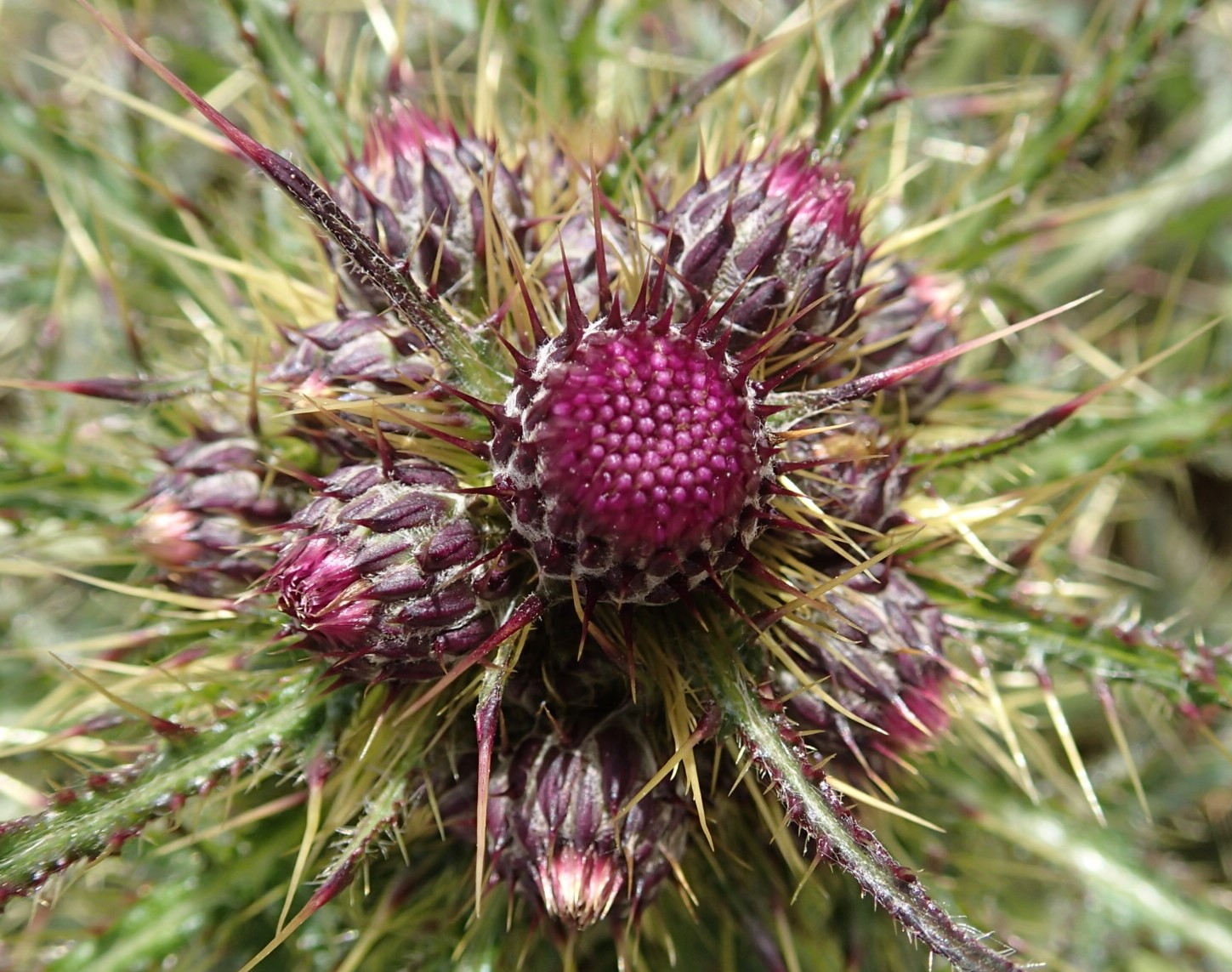
Left to right: Myosotis stolonifera, M. arvensis, Cirsium palustre
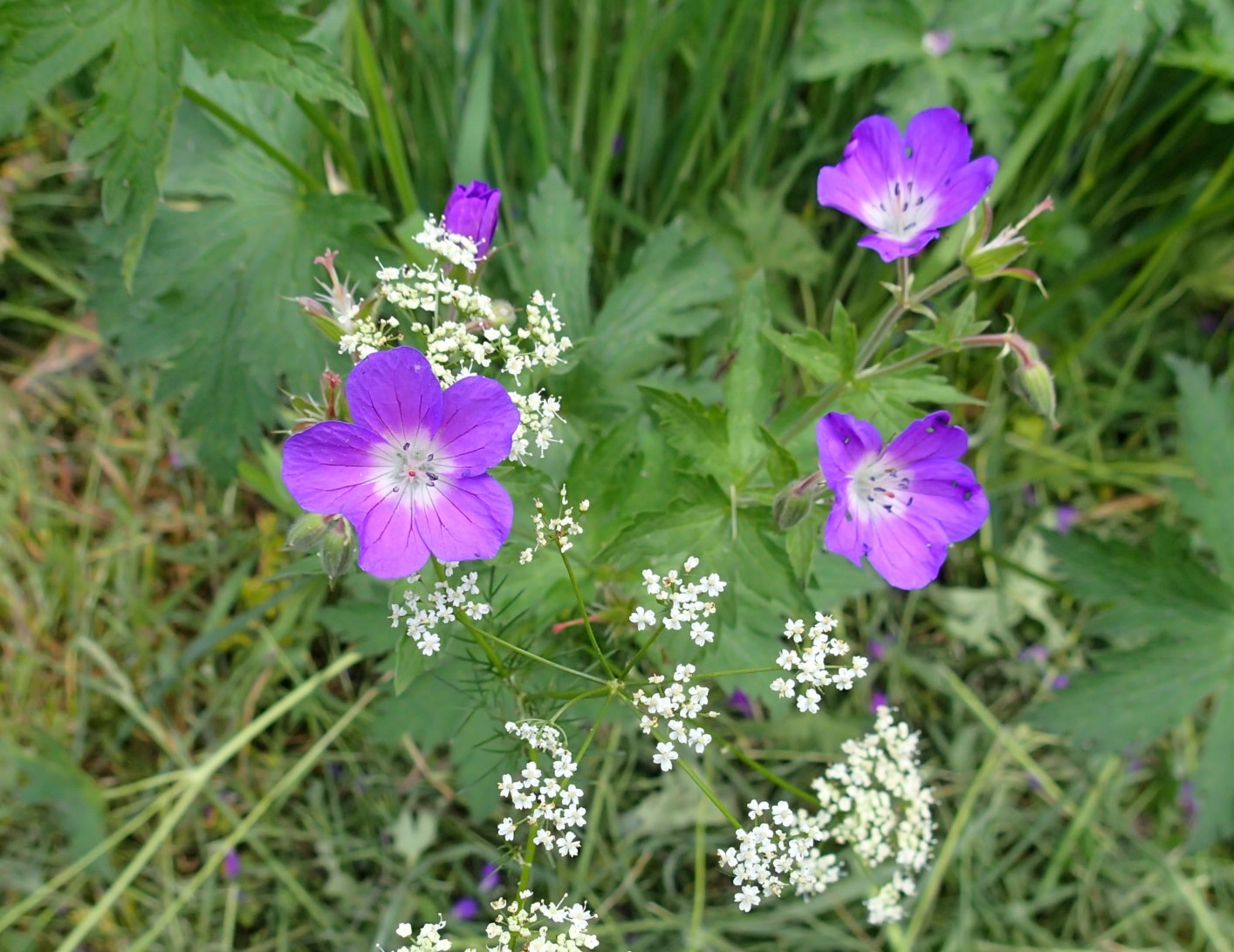
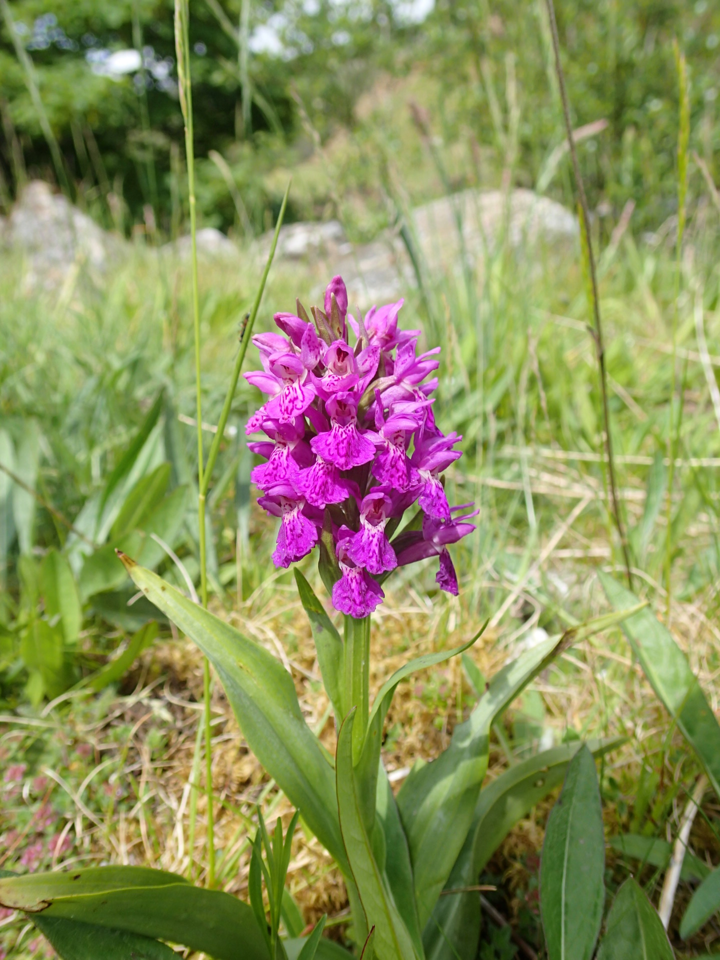
Dactylorhiza purpurella (left), Geranium sylvaticum and Conopodium majus (right)
After lunch we follow Killhope Burn most of the way to Cowshill. The water level is low enough to expose the flat limestone pavement over which it flows, through meadows full of pignut.

We notice the river bed looks different at Cowshill itself, the limestone slabs are tilted sharply. I think no more about it until I read afterwards that this is an extension of the ‘Burtreeford Disturbance’ north of the river, where we’ve hunted for fluorite on mine spoil heaps in the past.

Killhope Burn at Cowshill
The meadows along the river between here and the confluence at Wearhead are a disappointment – the farmer has clearly been busy with the glyphosate and everything except the grass is on its way out.

From Wearhead we are walking along the River Wear proper – at first through shady woodland with aniseed-scented Sweet Cicely, then through beautiful hay meadows – what a contrast !
It’s an easy walk along the north side of the river past Blackdene and then along the south side to the bridge at Daddry Shield.
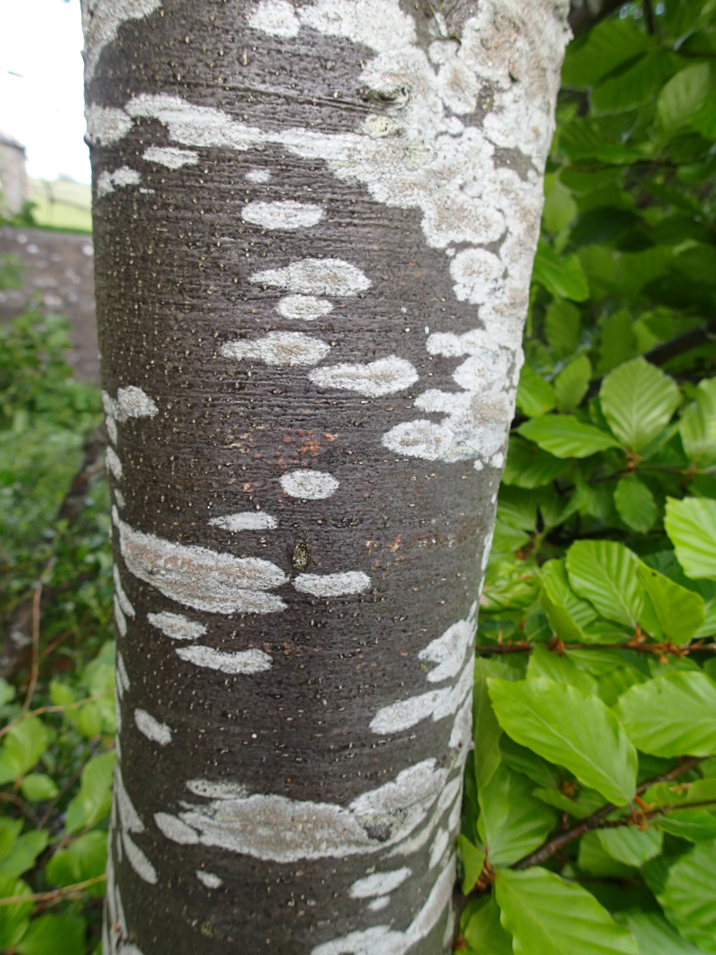
We notice beech trees with beautifully-patterned bark and one with a slightly confusing sign…

From Daddry Shield it’s just a short hop to Westgate to retrieve the car – three happy walkers at the end of our first day.

[…] path along the south side of the reservoir, like parts of the Weardale Way on Thursday, is not always easy to follow but we scramble through nettles and thistles, to a […]
[…] it’s taken us until September to get around to our second stint of the Weardale Way (see, The Weardale Way, Day 1). This week’s walk from Westgate to Eastgate seems a bit of an odd one as we don’t see the […]