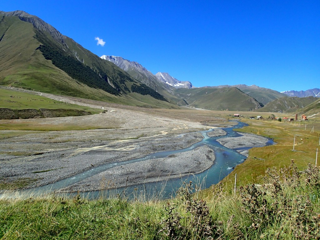
Our second long walk from our base in Stepantsminda took us along the scenic Truso valley, following the Terek river up towards its source. An area of great natural beauty, it’s also a bit of a geologists’ paradise. There are mineral springs and travertine deposits in the valley bottom and the surrounding mountains are made up of fantastically folded Jurassic limestone, fields of slates and schists, and volcanic ‘organ pipe’ formations, where intruding lava contracted as it cooled. The rocks tell the story of just how turbulent the geological history of the area has been and the scenery is spectacular; one of the flattest U-shaped valleys I’ve ever seen, apart from where the river has gouged an even deeper channel.
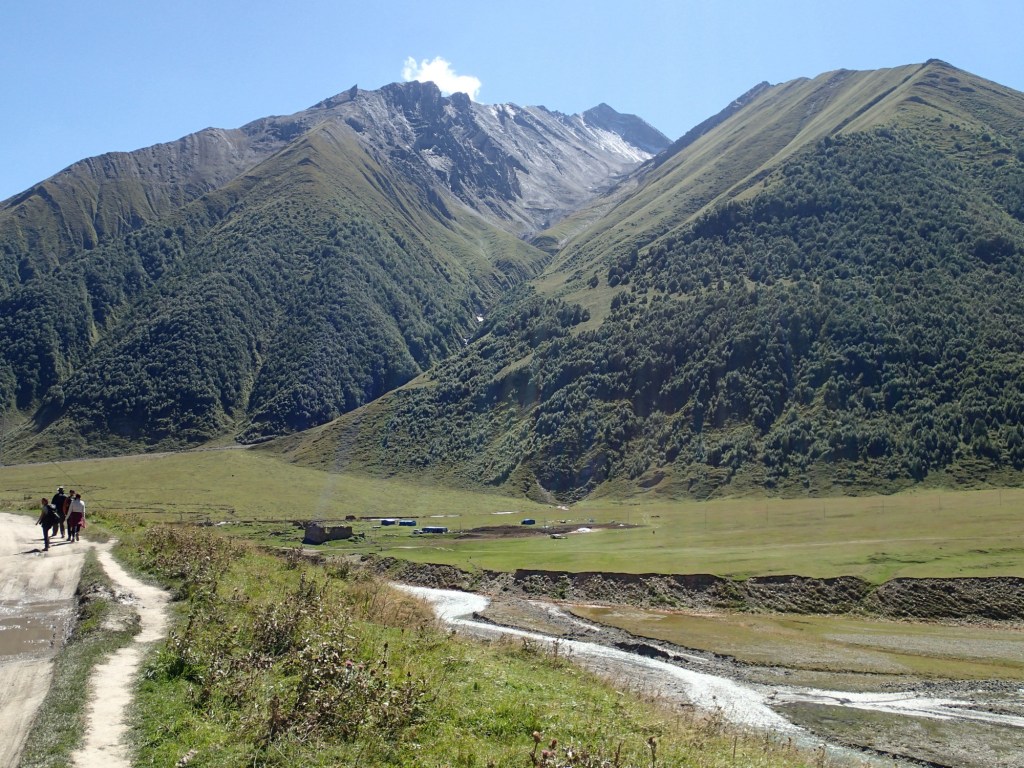
Like most people walking the valley, we got a lift to the semi-abandoned village of Kvemo Okrokana, then walked eight km or so along a gently-ascending track to the nunnery at Abano – a far cry from Tuesday’s climb. We didn’t get quite as far as the Zakagori Fortress ruins, on the border with Russian-occupied South Ossetia, but stopped at the picturesque nunnery to eat the bread and snacks we’d brought from the bakery at breakfast. We were a little disappointed to find the nuns were not selling the home-brewed beer we’d read about, but it was probably a good thing given that the day was warm enough, even in the mountains, for me to be in shorts and a T-shirt, and we had a long way to walk back!
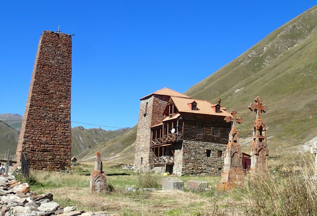
The village of Abano is now abandoned, apart from the four nuns and a priest who live there, as is Keterisi village and its fortress, which we passed en route. Both were abandoned in the 1990s, when Georgia was at war with Russia over South Ossetia, territory which most of the international community believe is Georgian. This small community, living so close to the border, seems to be about supporting Georgia’s claim to the territory and deterring further incursions, as well as about the nuns’ religious devotion and maybe the same is true of the monastery a little lower down the valley, where one or two monks live. The nunnery looks an idyllic place to live at this time of year but is cut off by road from the wider world for much of the winter, getting vital supplies via the military helicopters used to supply the border post.
The other residents of the valley are only there in summer; Azeri nomadic pastoralists with vast flocks of sheep and a herd of cows we watched being shooed out of the monastery grounds. The landscape reminds me of the Indian Himalayas, particularly Ladakh – the scale and emptiness is unlike anything I’ve experienced anywhere else in Europe.
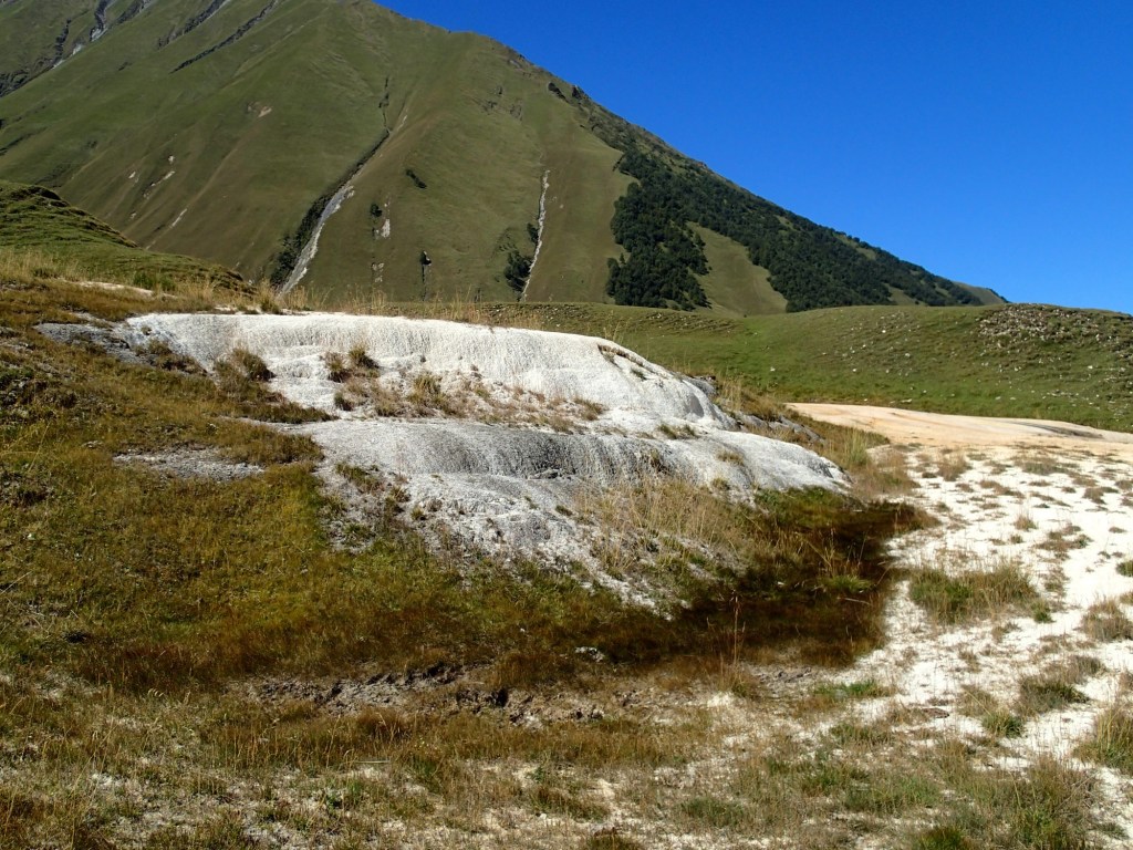
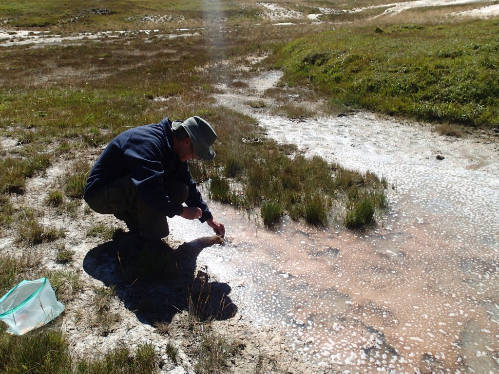
The travertine terrace formations we passed en route to Abano are spectacular. Faults deep underground in the Jurassic limestones beneath the valley floor allow highly mineralised waters, rich in carbon dioxide, to come to the surface under pressure. When the water reaches the surface and comes into contact with the air, the sudden drop in pressure causes calcium carbonate to precipitate out rapidly, forming theterraces. Their colour varies from creamy white, to rusty red and even black, depending on the specific minerals present and the specialised micro-organisms these feed. Of course theses had to be sampled for algae with the trusty toothbrush….
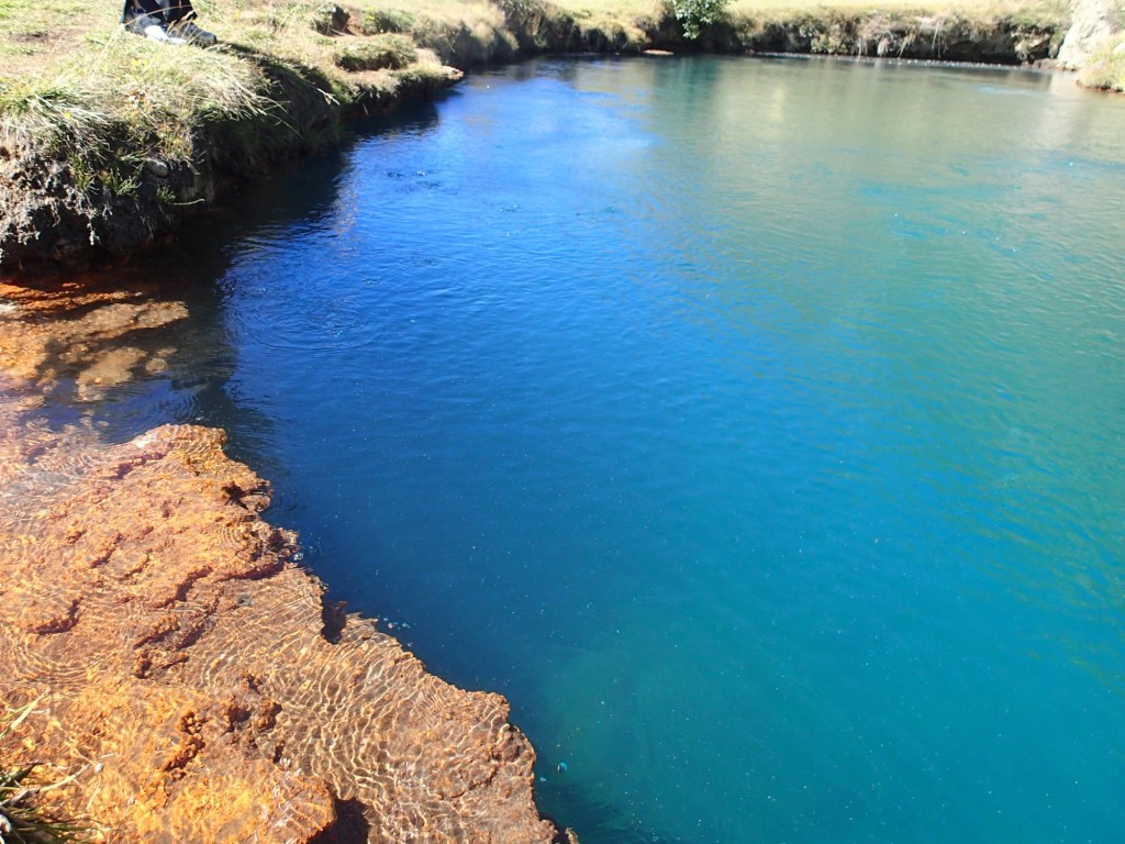
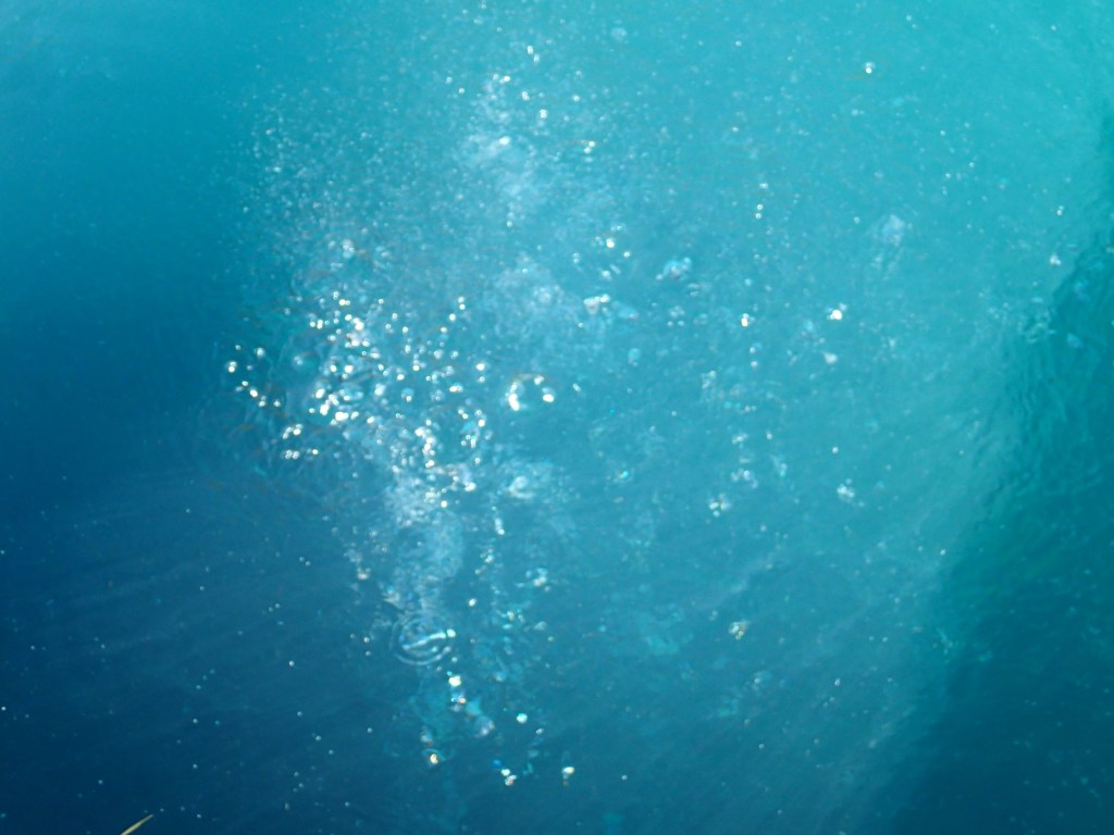
After lunch at Abano we returned along on the track on the far side of the river to see (and smell) the mineral springs of Narzan vaucluse, which pump up to 30 million litres of carbonated, sulphur-laden water into the river every day. The name ‘Albano mineral lake’ suggests something on a rather grander scale than the reality of its 0.04 hectare surface area but it is spectacular, nonetheless; the azure depths of the travertine-formed bowl from which the carbon dioxide bubbles up contrasts wildly with the outflow, stained brilliant orange by the iron oxide precipitating out.
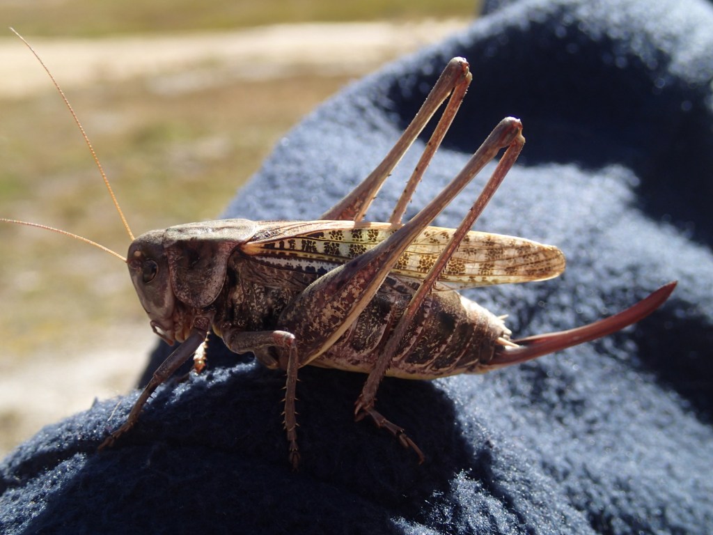
Despite the valley being very well grazed, there was plenty of insect life around – familiar butterflies like Tortoiseshells, Fritillaries and Small Blues, as well Mountain grasshoppers and one going by the splendid name of Wart-biter! Apparently it does what it says on the can; both the common and scientific names come from an 18th century folk medicine tradition in Sweden, where people put the insect onto a wart and allowed it to nibble it off!
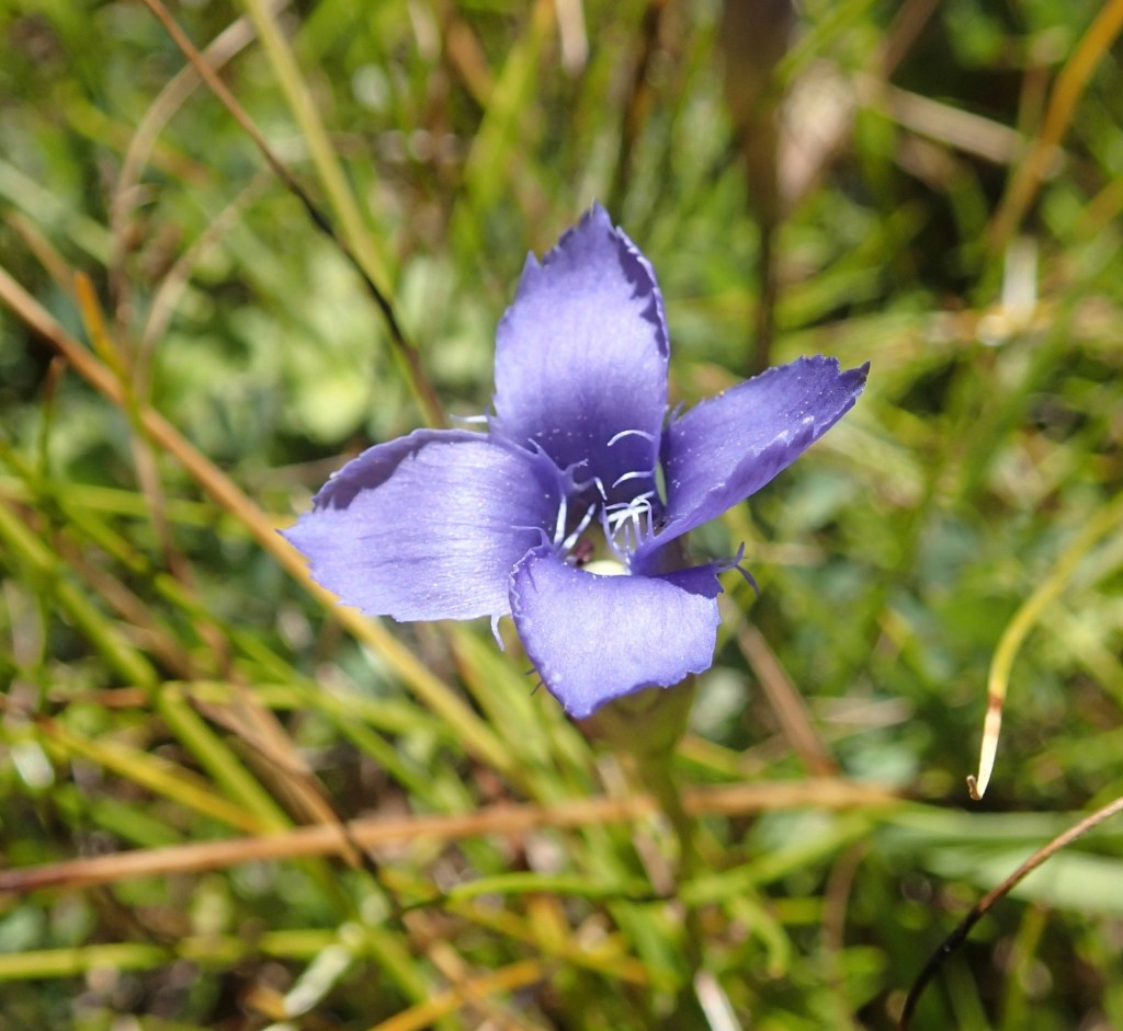
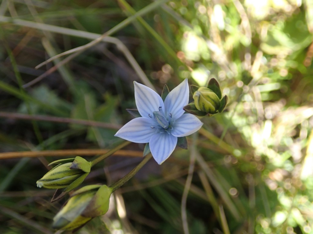
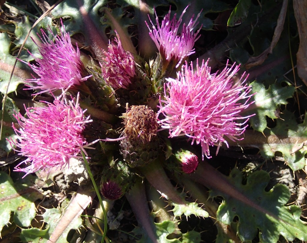
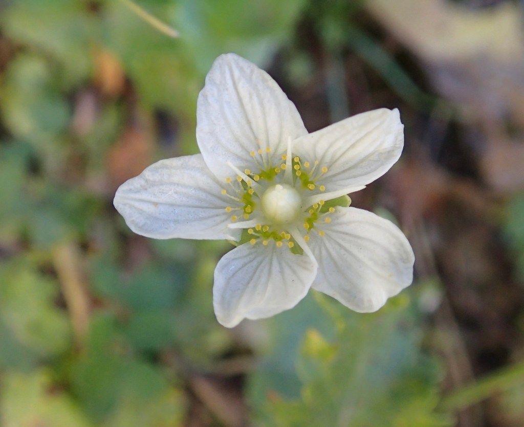
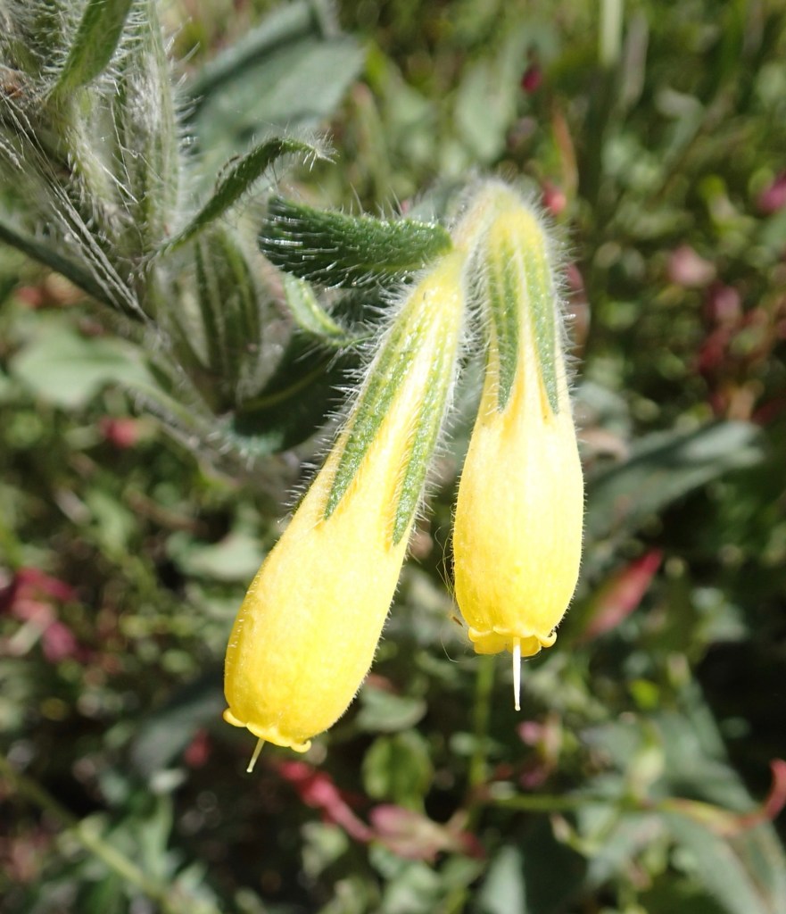
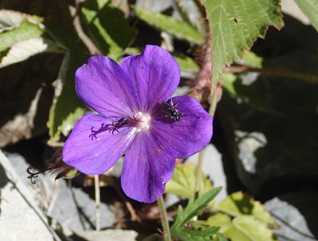
Of course there were plants too, including some I’d not seen elsewhere here; gentians Gentianopsis blepharophora, and Lomatogonium carinthiacum alongside masses of one of my favourite plants, Grass-of-Parnassus, in wetter areas by the river. I also found a single plant of Onosma caucasica growing on slaty scree beside the road. I’ve only seen this genus once before, growing on the serpentine rocks of the Troodos mountains in Cyprus, where Onosma troodi is endemic, which made me wonder if O. caucasica is also an indicator of metal rich soils. The whole genus are certainly plants which tolerate rocky, sandy soils.
One thing I’ve noticed throughout our time in the mountains is that the number and diversity of plants in the nitrogen-fixing pea family, the Fabaceae, is surprisingly low for an area with thin soils. I initially wondered whether that was to do with the origin of these soils (known as andosols), produced by rapid weathering of porous volcanic material, which typically results in very fertile soils because of the accumulation of stable organo-mineral complexes. However volcanic soils are not inherently nitrogen rich; nitrogen is a gas, easily driven off by heat. It seems that the other minerals in andosols may, though, promote the growth of bacteria capable of trapping nitrogen in the soil and, in turn, making it available to plants (Yokobe et al., 2020). Bob’s your uncle!
Today’s culinary highlight was our evening meal at Restaurant Khevi in town, particularly the walnut pate wrapped in slices of grilled aubergine (nigvziani badrijani) and a salad with tart green apples.
Yokobe, T., Hyodo, F. & Tokuchi, N. (2020). Volcanic deposits affect soil nitrogen dynamics and fungal–bacterial dominance in temperate forests.
Soil Biology and Biochemistry, 150, 108011. ISSN 0038-0717.


Gorgeous scenery
Another fascinating blog! I’m having fun following your travels on Google maps (which is sprinkled with markers for travertine deposits – appropriate for the “International Day of karst and caves”!)
That flat bottomed U – any chance it is an old lake bed? I see them around in the alps where a lake has eventually undammed itself but left behind a completely planar valley floor.
Glad you’re enjoying! The lake one is an interesting idea, but I can’t find any evidence of anything apart from glaciation and tectonic uplift, I’m afraid
In that case, with no other evidence, it is probably just deposits from a mature, meandering river!
The Truso valley geology notes are a treat — those travertine terraces and folded Jurassic limestone details make the walk feel richer than a pure scenery dump. I like how you keep the river-sourced U-shaped valley description grounded without overclaiming a lake-bed story. Bookmarking this before I dig into the Caucasus maps.
Thanks!