Running my normal route up to Quarrington Hill didn’t seem sensible this morning looking at the icy paths from our windows so the question was whether to run somewhere lower down or to ditch the run in favour of a walk with a camera. I’m so glad I decided on the latter.
I run through part of the upper part of Crowtrees Local Nature Reserve most weeks and enjoy the orchids there in the summer but haven’t explored the woodland and ponds at the bottom of the valley before. It always great to discover new wildlife havens on my doorstep.
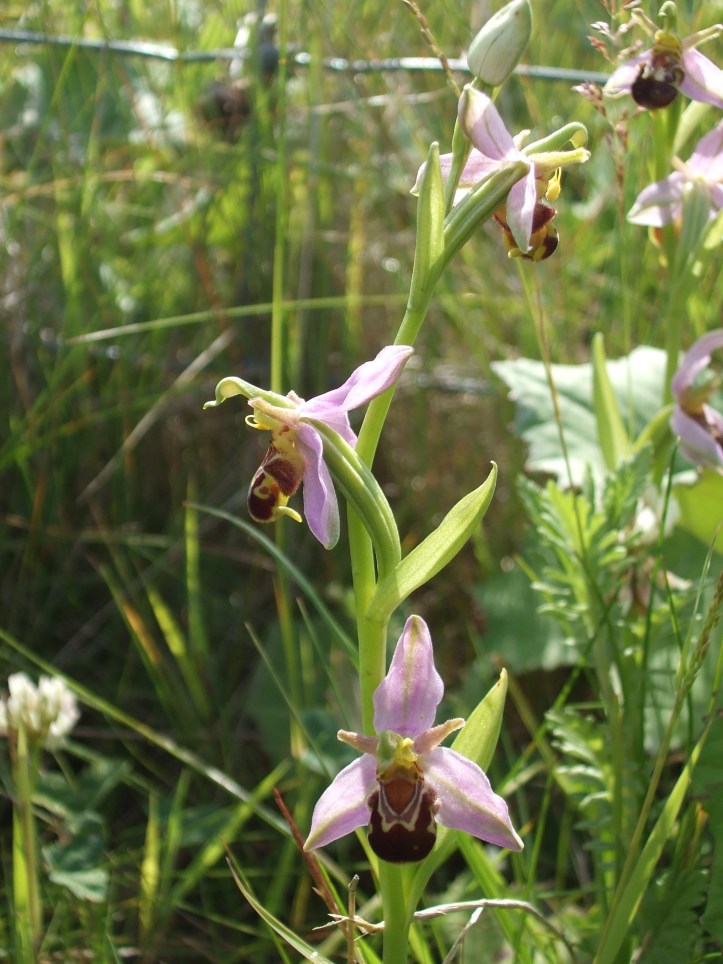

Bee (Ophrys apifera) above and Early purple orchids (Orchis mascula) below at Crowtrees LNR, July 2012
Crowtrees turns out to be a SSSI for the combination of blue moor grass and small scabious found amidst its Magnesian limestone grassland.
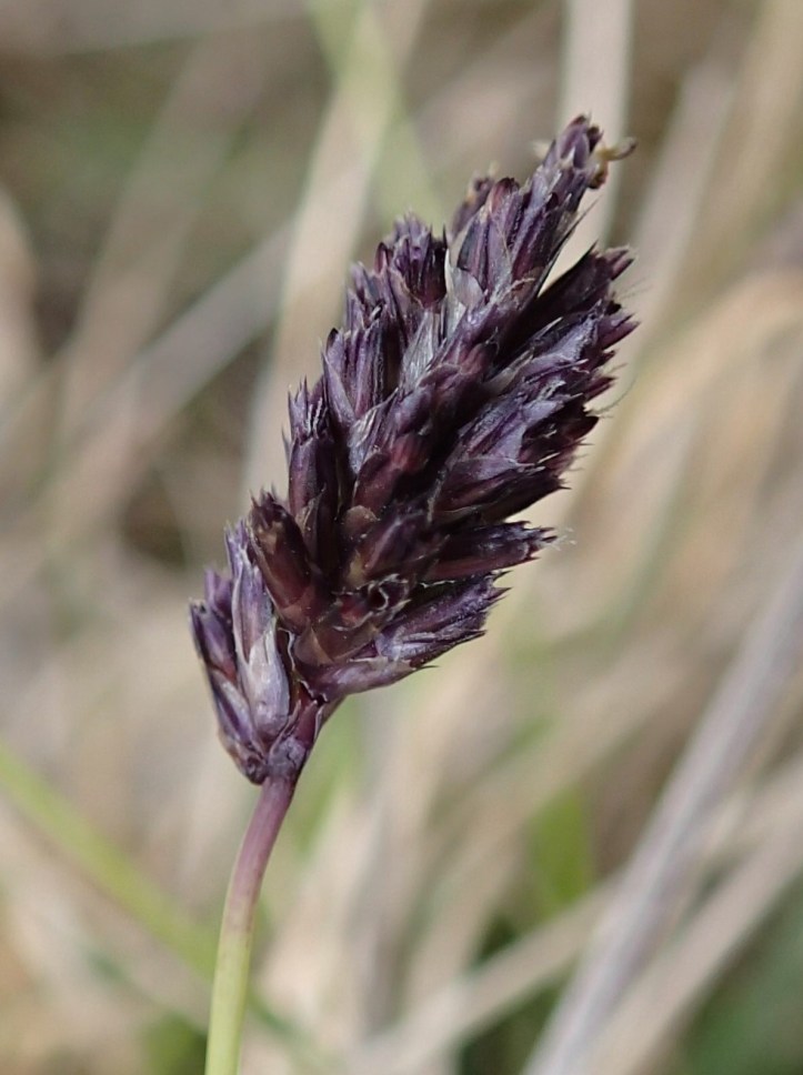
Blue moor grass (Sesleria caerulea) at nearby Thrislington NNR, April 2014
Looking at the hillside around the reserve it’s not hard to work out the origins of the name Quarrington Hill (the hill where quernstones, for milling, were quarried). The stone for St Paul’s Church, which used to stand on the edge of the limestone escarpment, was apparently brought from nearby quarries in the local publican’s cart in the 19th Century and limestone from here was burnt to produce lime for the cement which holds Durham Cathedral together. Quarrying has shaped much of the landscape in and around the reserve.

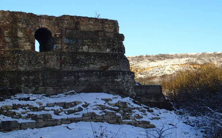
Snow reveals the site of one of the old quarries below Quarrington Hill
Hepplewhites, who still extract limestone and sand from Old Quarrington Quarry, have just been given permission to start extraction of sand again from the adjacent Cold Knuckles Quarry, to some local dismay. However limestone will not be extracted from this site and, after extraction of sand, the area will be backfilled with construction waste and the escarpment reconstructed to allow restoration of the Magnesian limestone grassland.

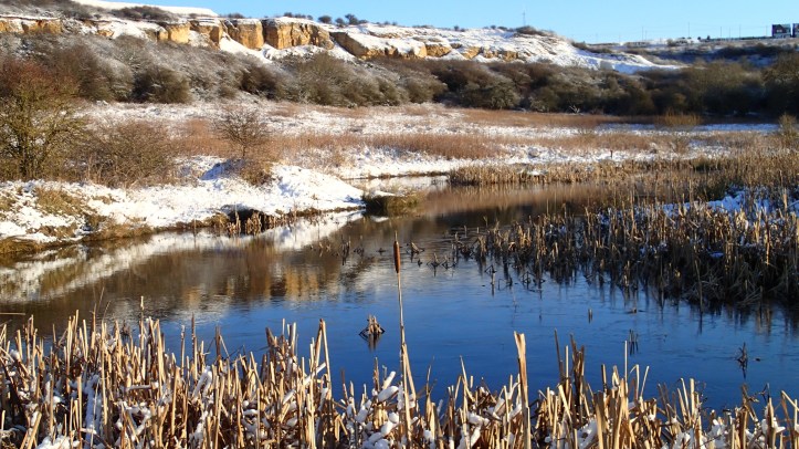
The Magnesian Limestone escarpment of Cold Knuckles Quarry in the snow
I’m somewhat sceptical of the efficacy of such large-scale reshaping of the environment but have to admit I get an enormous amount of pleasure every year from the translocated Magnesian Limestone grassland adjacent to nearby Thrislington Quarry.
 Dark red Helleborine (Epipactis atrorubens) at Thrislington NNR, July 2014
However it’s not just limestone and sand which was extracted from Quarrington Hill. Like much of the rest of County Durham, there is coal beneath the sand and there have been three, separate collieries on the site. The first was just a shallow drift mine but the second and third, operating in the latter half of the 19th Century, were deep mines sunk beneath the Permian rocks at Quarrington Hill. I stumbled across the remains of the engine house from the third pit today.
Remains of the engine house of Crowtrees pit
As well as the Magnesian grassland, Crowtrees LNR also sports a number of small ponds, presumably the result of mining subsidence. Even in today’s snow it was clear these offer a range of different habitats – some seemed more or less devoid of plant life whereas others were full of Canadian pondweed. I suspect Martyn will be keen to look at these later in the year to see what they contain in the way of algae. Seeds of the abundant bull rushes must be a boon for birds at this time of year when food is in short supply.
Bull rushes (Typha latifolia) growing in the ponds at Crowtrees LNR
It’s clear that the rosehips are also providing food for hungry birds at the moment.

Now I’m keen to go back and see what is growing on other parts of the reserve later on in the year…

[…] had a proper explore one morning in January when the paths were too icy for my normal run (see ‘Too icy to run’). Now it’s in full bloom with plenty of […]
[…] As we climb the hill beyond the ponds, the most obvious feature of the hillside opposite is the great chunk of escarpment which has been quarried in the last 18 months or so since Hepplewhites started extracting sand and limestone again from Cold Knuckles Quarry (see Too icy to run). […]
[…] The limestone at Raisby Hill is the oldest layer of the so-called Magnesian limestone, laid down during the Permian period just under 300 Million years ago, when the hot, arid landmass of which Britain was a part lay near the Equator and was periodically inundated by the shallow Zechstein Sea. This layer forms much of the escarpment which marks the edge of the Magnesian limestone plateau, running in a NE to SW direction from South Sheilds to Newton Aycliffe, including the area currently being quarried above Crowtrees LNR. […]